

Road Maintenance
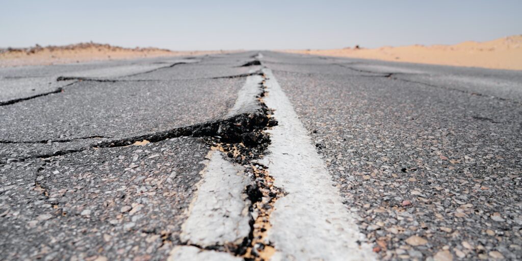
Have you ever experienced bumpy, pothole-pitted roads recently? Well you’re not alone. According to the AAA, an estimated 44 million drivers in the US have experienced vehicle damage due to a pothole that required repair in 2022, marking a 57% increase from the previous year. Potholes are more than just an inconvenience – they are a real hazard to all road users. Even a small pothole can produce a surprising amount of damage. The pothole crisis is costing Americans in terms of money, time, stress – and for some, even their lives.
American drivers on average have spent $406 per person in 2022 repairing car damage caused by potholes. These same drivers also report experiencing pothole damage multiple times. This alarming trend highlights the urgent need for immediate attention and investment in the maintenance and repair of America’s roadways. While human visual inspection consumes precious manpower and yields subjective evaluations, inspection by sensor package-equipped vehicles is costly and time-consuming. Furthermore, both methods are unable to detect and report road damage issues in real-time.
However, maintaining roads and public infrastructure doesn’t have to be costly, time consuming, or subjective. With Aisin’s Road Maintenance Service(ARMS), municipalities can proactively detect and address potholes and other road damage before they worsen which can further increase the pavement lifecycle. Furthermore, municipalities can reduce the costs of manual surveys by leveraging existing fleets to collect the data needed to maintain public roads and assets.
ARMS – Aisin Road Maintenance Service
ARMS is a road damage detection software that leverages the Aisin Location-Based Services(LBS) Platform’s high-accuracy location data and machine learning algorithms to deliver accurate, real-time data on roads and infrastructure and helps to reduce the costs and resources associated with road survey activities. By simply installing the ARMS edge computing unit and HD image camera, municipalities can capture crucial road condition data from vehicles that perform routine activities such as garbage collection and street cleaning.
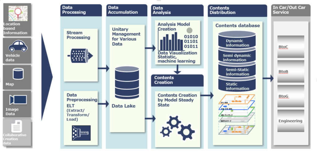
Aisin Location-Based Services (LBS) Platform
ARMS utilizes Aisin’s Location-Based Services (LBS) Platform. Through many decades of experience providing navigation systems to the world’s largest automotive OEMs, Aisin is able to provide numerous products and services that leverage our expertise in geo-location technology. The LBS Platform utilizes data that is captured from various endpoints including vehicle data, map data, image data, and Aisin’s proprietary machine learning and AI algorithms to deliver data that can be used for a multitude of B2C, B2B, B2G and engineering applications.
Features of ARMS
ARMS originated as a system that utilized vehicle sensor data to detect potholes. By analyzing wheel speed and suspension data, Aisin was able to detect surface anomalies including potholes and surface unevenness. ARMS now leverages HD image camera technology to capture road surface imagery and analyzes it with Aisin’s proprietary AI algorithms and deep learning library to accurately detect a wide range of road surface defects.
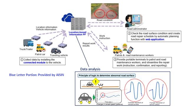
Currently, ARMS is able to detect potholes and cracks as well as pavement ride quality as measured by the International Roughness Index (IRI). ARMS rates the severity of the defect using a proprietary scale. It can also be customized to the measurement needs of the municipality and integrated with existing defect scales. ARMS, along with road surface defects, can also detect weather-related issues such as snow and ice. It can also track municipal assets such as street signs, safety barriers, and sidewalks with its HD image camera, thus giving municipalities more data on their managed assets.
The ARMS Advantage
ARMS is a cost-effective road damage detection software solution that can help manage municipal assets. Cities can choose to implement ARMS as their primary system road management or use it to supplement existing survey activities. ARMS can eliminate the need for manual surveys by monitoring road surfaces from garbage trucks, street sweepers, etc as they perform their routine activities. It can also digitize existing manual processes and supplement other infrequently conducted road surveys. For instance, municipalities who perform annual road surveys, either in-house or via a 3rd party contractor, can utilize ARMS to detect issues that occur between surveys. ARMS can also be used to validate manual survey results.